Disclosure : This site contains affiliate links to products. We may receive a commission for purchases made through these links.
Admiralty Chart 2682 – Barents Sea Northern Part
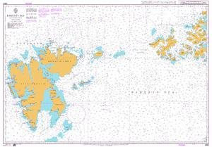
NEW EDITION OUT ON 09/04/2020Admiralty standard nautical charts comply with Safety of Life at Sea (SOLAS) regulations and are ideal for professional, commercial and recreational use. Charts within the series consist of a range of scales, useful for passage planning, ocean crossings, coastal navigation and entering port.Standard Admiralty charts are folded to fit in a chart table drawer. If you prefer your Admiralty charts rolled without any folds or creases (suitable for framing), contact us before ordering on +44(0)207 759 7150 or maritime@stanfords.co.uk.
Related Products:
 Admiralty Chart 2683 – Barents Sea, Southern Part
 Admiralty Chart 369 – Northern Martinique
 Admiralty Chart 2592 – Lillebaelt Northern Part
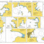
 Admiralty Chart 1636 – Plans in the Northern Aegean Sea
 Admiralty Chart 2065 – Northern Antigua
 Admiralty Chart 327 – Northern Approaches to Yanbu`
 Admiralty Chart 2972 – Port of Riga-Northern Part
 Admiralty Chart AUS25 – Port Darwin (Northern Sheet)
 Admiralty Chart 1638 – Plans in Northern Vanuatu
 Admiralty Chart 1419 – Coco Channel and Northern Approaches to Port Blair
 Admiralty Chart 2854 – Northern Approaches to Masirah
 Admiralty Chart 695 – Northern Approaches to Toamasina (Tamatave)
 Admiralty Chart IN31 – Bay of Bengal, Northern Part
 Admiralty Chart 3962 – Northern Approaches to Rio Amazonas
 Admiralty Chart 2738 – Lakshadweep Sea Northern Part
 Admiralty Chart 594 – Southern Guadeloupe to Northern Martinique
 Admiralty Chart 2479 – Inner Sound – Northern Part
 Admiralty Chart 1531 – Harbours in the Northern Dhodhekanisos
 Admiralty Chart 1520 – Canal de Maracaibo Northern Part
 Admiralty Chart 793 – The Grenadines – Northern Part
 Admiralty Chart 890 – Grundkallen to Bjorn with Northern Approaches to Oregrund
 Admiralty Chart 1233 – Northern Approaches to the Shetland Islands
 Admiralty Chart 1681 – Northern Shore of Sibuko Bay
 Admiralty Chart AUS781 – Gulf of St Vincent (Northern Portion)
 Admiralty Chart 2677 – Zalew Szczecinski, Northern Part
 Admiralty Chart 2562 – Plans in the Northern Orkney Islands
 Admiralty Chart 714 – Plans in the Phoenix and Northern Line Groups
 Admiralty Chart IN2039 – Gulf of Khambhat Northern Portion
 Admiralty Chart 3560 – Gerlache Strait Northern Part
 Admiralty Chart 1785 – North Minch – Northern Part
 Admiralty Chart 3930 – Northern Approaches to Istanbul Bogazi
 Admiralty Chart 3786 – Approached to Bahrain – Northern part
 Admiralty Chart 2558 – Falkland Sound Northern Part
 Admiralty Chart 2199 – North Channel – Northern Part
 Admiralty Chart 2387 – Firth of Lorn Northern Part
 Admiralty Chart 3364 – Zhangjiang Gang Northern Part
 Admiralty Chart NZ8247 – Haapai Group Northern Portion
 Admiralty Chart 2685 – Kara Sea, Northern Part
 Admiralty Chart 247 – Iskenderun Korfezi Northern Terminals
 Admiralty Chart 1538 – Plans in the Northern Kikladhes


