Disclosure : This site contains affiliate links to products. We may receive a commission for purchases made through these links.
Disclosure : This site contains affiliate links to products. We may receive a commission for purchases made through these links.
Categories
-
Best Sellers
-
St. Gallen
Street plan of St. Gallen and the neighbouring communities, with an enlargement for the city centre. The plan shows public transport and car parks. A separate Read More » -
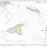
NOAA Chart 16423 – Shemya Island to Attu Island (Metric)
NOAA maintains the nautical charts and publications for U.S. coasts and the Great Lakes. Over a thousand charts cover 95,000 miles of shoreline and 3.4 million Read More » -
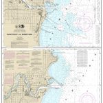
NOAA Chart 14922 – Manitowoc and Sheboygan
NOAA maintains the nautical charts and publications for U.S. coasts and the Great Lakes. Over a thousand charts cover 95,000 miles of shoreline and 3.4 million Read More » -

Gran Canaria K+F Outdoor Map
Gran Canaria at 1:50,000 on a sturdy, waterproof and tear-resistant, GPS compatible map from Kรผmmerly + Frey. The map divides the island north/south, with an overlap Read More » -
Star Wars Construction Books
-

Omnibus: A Social History of the London Bus
This book is a comprehensive social history of how the London bus has worked in, and for, the capital for the last century and a half. Read More » -

Haamstede
-

Leftover in China: The Women Shaping the World`s Next Superpower
Forty years ago in China, marriage was universal, compulsory and a woman`s only means to a livelihood. Then the one-child policy resulted in China`s first generations Read More » -

Polar Region: British Antractic Survey`s Special Topographic and Earth Sciences Maps
-

LONDON FOLD-OUT Poster Sticker Book
-


