Disclosure : This site contains affiliate links to products. We may receive a commission for purchases made through these links.
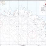
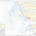
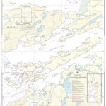
1510 Greenland Westcoast – Tugtulik to Egedesminde
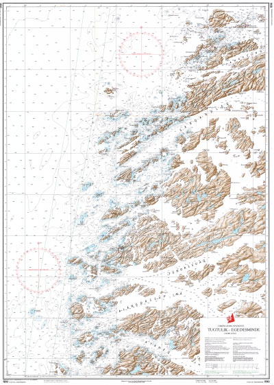
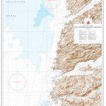
Official charts for the coast of Greenland produced by the Danish Hydrographic Office. The charts are ordered upon customer demand, therefore please contact us if you require the charts urgently.For any further information, you can contact maritime@stanfords.co.uk.

Related Products:
 1530 Greenland Westcoast – Egedesminde
 1511 Greenland Westcoast – Egedesminde to Godhavn
 1512 Greenland Westcoast – Egedesminde to Christianshab
 1416 Greenland Westcoast – Faeringe Nordhavn to Tugtulik
 1000 Greenland Westcoast
 1130 Greenland Westcoast – Frederiksdal
 1131 Greenland Westcoast – Nanortalik
 1132 Greenland Westcoast – Julianehab
 1145 Greenland Westcoast – Kobberminebugt
 1230 Greenland Westcoast – Frederikshab
 1100 Greenland Westcoast – Kap Farvel to Arsuk
 1200 Greenland Westcoast – Arsuk to Graedefjord
 1300 Greenland Westcoast – Graedefjord to Hamborgerland
 1400 Greenland Westcoast – Hamborgerland to Rifkol
 1500 Greenland Westcoast – Rifkol to Hareo
 1600 Greenland Westcoast – Hareo to Proven
 1700 Greenland Westcoast – Proven to Holms
 3100 Greenland Westcoast – Holms to Saunders
 3200 Greenland Westcoast – Kap York to Kap Chalon
 1113 Greenland Westcoast – Igdlukasik to Sydproven
 1114 Greenland Westcoast – Sydproven to Julianehab
 1117 Greenland Westcoast – Magelob to Kobberminebugt
1210 Greenland Westcoast – Tornarssuk Lob to Frederikshab
1117 Greenland Westcoast – Magelob to Kobberminebugt
1210 Greenland Westcoast – Tornarssuk Lob to Frederikshab
 1513 Greenland Westcoast – Christianshab to Jakobshavn
 1610 Greenland Westcoast – Umanak to Marmorilik
 1710 Greenland Westcoast – Proven to Upernavik
 1146 Greenland Westcoast – Arsuk Fjord
 1231 Greenland Westcoast – Qeqertarsuatsiaat (Fiskenaesset)
 1333 Greenland Westcoast – Niaqunngunaq (Fiskefjord)
 1335 Greenland Westcoast – Maniitsoq (Sukkertoppen)
 1430 Greenland Westcoast – Sisimiut (Holsteinsborg)
 1161 Greenland Westcoast – Simiutaq to Qarmat
 1350 Greenland Westcoast – Orsiivik (Polaroil)
 1118 Greenland Westcoast – Kobberminebugt to Tornarssuk Lob
 1164 Greenland Westcoast – Naajat (Magelob), Ikerasassuaq
 1415 Greenland Westcoast – Holsteinsborg to Faeringe Nordhavn
 3130 Greenland Westcoast – North Star Bugt
 1162 Greenland Westcoast – Qarmat, Naajat (Magelob)
 1167 Greenland Westcoast – Itilliatsiaq (Nyboes Kanal), Qipisaqqu
 1353 Greenland Westcoast – Aqissersiorfik to Nuuk (Rypeo to Godthab)