Disclosure : This site contains affiliate links to products. We may receive a commission for purchases made through these links.
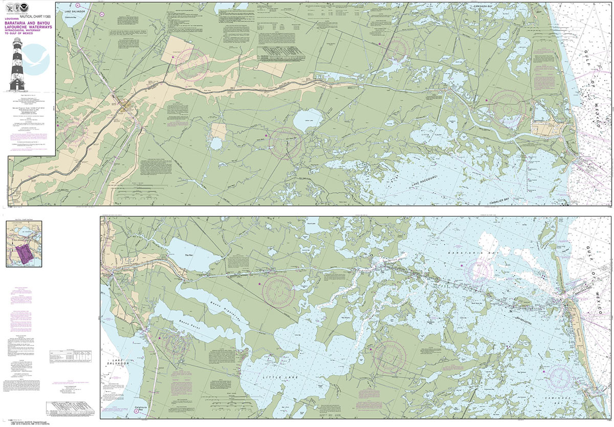
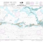
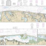
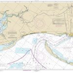
NOAA Chart 11365 – Barataria and Bayou Lafourche Waterways’”Intracoastal Waterway to Gulf of Mexico
NOAA maintains the nautical charts and publications for U.S. coasts and the Great Lakes. Over a thousand charts cover 95,000 miles of shoreline and 3.4 million square nautical miles of waters.Printed on demand using the most up to date NOAA data and latest Notice to Mariners (NTMs) applied at time of print. Meets United States Coast Guard carriage requirements.Printed in house at Stanfords.

Related Products:
 NOAA Chart 11350 – Intracoastal Waterway’”Wax Lake Outlet to Forked Island, including Bayou Teche, Vermilion River and Freshwater Bayou
 NOAA Chart 11353 – Intracoastal Waterway’”New Orleans to Calcasieu River, East Section – Baptiste Collette Bayou Extension
 NOAA Chart 411 – Gulf of Mexico
 NOAA Chart 11446 – Intracoastal Waterway’”Sugarloaf Key to Key West
 NOAA Chart 11449 – Intracoastal Waterway’”Matecumbe to Grassy Key
 NOAA Chart 11465 – Intracoastal Waterway’”Miami to Elliott Key
 NOAA Chart 11367 – Intracoastal Waterway’”Waveland to Catahoula Bay
 NOAA Chart 11390 – Intracoastal Waterway’”East Bay to West Bay
 NOAA Chart 11331 – Intracoastal Waterway – Ellender to Galveston Bay
 NOAA Chart 11322 – Intracoastal Waterway – Galveston Bay to Cedar Lakes
 NOAA Chart 11411 – Intracoastal Waterway’”Tampa Bay to Port Richey
 NOAA Chart 11464 – Intracoastal Waterway’”Blackwater Sound to Matecumbe
 NOAA Chart 12324 – Intracoastal Waterway’”Sandy Hook to Little Egg Harbor
 NOAA Chart 11308 – Intracoastal Waterway’”Redfish Bay to Middle Ground
 NOAA Chart 11402 – Intracoastal Waterway’”Apalachicola Bay to Lake Wimico
 NOAA Chart 11463 – Intracoastal Waterway’”Sands Key to Blackwater Sound
 NOAA Chart 11425 – Intracoastal Waterway’”Charlotte Harbor to Tampa Bay
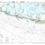
 NOAA Chart 11445 – Intracoastal Waterway’”Bahia Honda Key to Sugarloaf Key
 NOAA Chart 11453 – Intracoastal Waterway’”Grassy Key to Bahia Honda Key
 NOAA Chart 11372 – Intracoastal Waterway’”Dog Keys Pass to Waveland
 NOAA Chart 11393 – Intracoastal Waterway’”Lake Wimico to East Bay
 NOAA Chart 11448 – Intracoastal Waterway’”Big Spanish Channel to Johnston Key
 NOAA Chart 11507 – Intracoastal Waterway’”Beaufort River to St. Simons Sound
 NOAA Chart 11518 – Intracoastal Waterway’”Casino Creek to Beaufort River
 NOAA Chart 11467 – Intracoastal Waterway’”West Palm Beach to Miami
 NOAA Chart 11485 – Intracoastal Waterway’”Tolomato River to Palm Shores
 NOAA Chart 11374 – Intracoastal Waterway’”Dauphin Island to Dog Keys Pass
 NOAA Chart 11385 – Intracoastal Waterway’”West Bay to Santa Rosa Sound
 NOAA Chart 11489 – Intracoastal Waterway’”St. Simon Sound to Tolomato River
 NOAA Chart 11489 – Intracoastal Waterway’”St. Simons Sound to Tolomato River
 NOAA Chart 12316 – Intracoastal Waterway’”Little Egg Harbor to Cape May – Atlantic City
 NOAA Chart 11314 – Intracoastal Waterway’”Carlos Bay to Redfish Bay, including Copano Bay
 NOAA Chart 11319 – Intracoastal Waterway’”Cedar Lakes to Espiritu Santo Bay
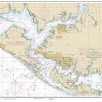
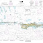
 NOAA Chart 11358 – Barataria Bay and Approaches
 NOAA Chart 11541 – Intracoastal Waterway’”Neuse River to Myrtle Grove Sound
 NOAA Chart 11378 – Intracoastal Waterway’”Santa Rosa Sound to Dauphin Island
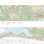
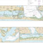
 NOAA Chart 11345 – Intracoastal Waterway’”New Orleans to Calcasieu River, West Section
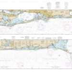
 NOAA Chart 11352 – Intracoastal Waterway’”New Orleans to Calcasieu River, East Section
 NOAA Chart 11306 – Intracoastal Waterway’”Laguna Madre’”Middle Ground to Chubby Island
 NOAA Chart 11404 – Intracoastal Waterway’”Carrabelle to Apalachicola Bay – Carrabelle River