Disclosure : This site contains affiliate links to products. We may receive a commission for purchases made through these links.
Guangzhou & China South ITMB
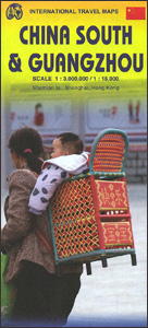
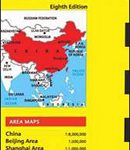
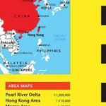
Street plan of Guangzhou with on the reverse a map of southern China from ITMB, both indexed, plus additional panels an enlargement of the Shamian Island, a more detailed Guangzhou regional map, a street plan of Shanghai, and detailed coverage of Hong Kong.On one side is street plan of Guangzhou with coverage extending north to include Balyun Mountain and the The White Cloud Mountain Resort, and south across the Pearl River to Sun Yat-Sen University campus. East/west, the map extends from the various academic institutions in the Wushan district to the Datansha Island and the Zhujiang West Bridge. The map highlights traffic arteries across the city and prominently indicates public transport connections: metro stations shown with entrances/exits, local bus stands, ferry piers, coach terminals and intercity railway stations. Symbols highlight selected tourist accommodation, places of interest, public buildings and various facilities, etc. The plan is indexed and also includes an enlargement for the Shamian Island Historic Urban District, a diagram of the metro and suburban rail networks and a small map showing the city’s road connections with Hong Kong and Macao.On the reverse is an indexed map of south-eastern China at 1:3,000,000, extending from Shanghai southwards to the Hainan Island, and west to Chengdu and Kunming. The map shows the region`s road and rail network on a base with altitude colouring (bands in feet, spot heights in metres). This side also includes detailed street plans of central Shanghai, Hong Kong and Kowloon, all three annotated with locations of hotels and various facilities, plus a map of the Hong Kong Region.Please names on all the maps and street plans are in the Latin alphabet only.

Related Products:
 China South ITMB
 Shanghai & China South East ITMB
 China Periplus Travel Map
 Hong Kong & Macau Periplus Travel Map
 Hong Kong & Region ITMB
 South East Asia ITMB
 China East ITMB
 Hong Kong Marco Polo City Map
 Sri Lanka & India South ITMB
 Oslo / Bergen & South of Norway ITMB
 Auckland & North Island ITMB
 South America ITMB
 Ho Chi Minh City / Saigon & Vietnam South ITMB
 Miami & South Florida ITMB
 Hong Kong Nelles
 San Diego & USA South West Border ITMB
 Sao Paulo & Brazil South Coast ITMB
 China West ITMB
 Kyoto & Japan West ITMB
 Chile South & Patagonia ITMB
 Accra & Ghana South ITMB
 China South Central
 Hong Kong – Macau Guide Map
Sydney & Australia East ITMB
Hong Kong – Macau Guide Map
Sydney & Australia East ITMB
 Macau Flexi Map
 Osaka & Western Japan ITMB
 Cusco & Peru South ITMB
 South Africa – Lesotho – Swaziland ITMB
 Bangkok & Thailand South ITMB
 USA South: Atlantic States ITMB
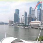 Singapore & Malay Peninsula ITMB
 Paraguay – Bolivia South ITMB
 Zurich & Switzerland NW ITMB
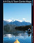 South Island with 6 Town Centre Kiwimaps
 Shanghai Periplus Travel Map
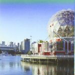 British Columbia South ITMB
 Bangladesh & India East ITMB
 Berlin & Eastern Germany ITMB
 Cairo & Nile Delta ITMB