Disclosure : This site contains affiliate links to products. We may receive a commission for purchases made through these links.
California De Long Wine Wall Map
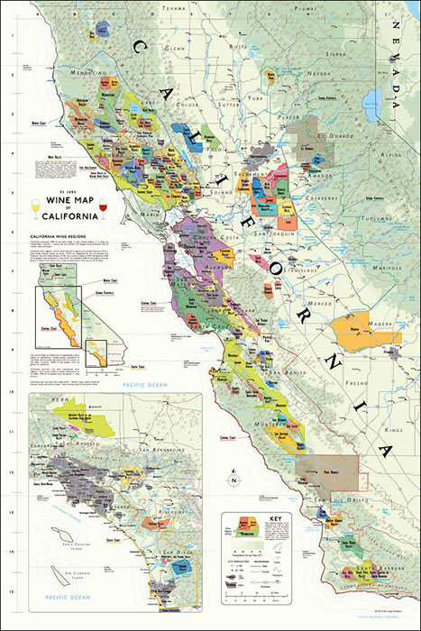
California Wine Wall Map from De Long Company, size 61 x 92 cm / 24″ x 36″, presents in an attractive pastel colouring the state’s officially designated AVA (American Viticultural Areas) winegrowing regions. An overview map of the whole state shows which two parts of it are presented in detail on the main panels at 1:715,000 approx.One panel covers the three main wine growing areas of northern and central California: the North Coast and the Central Coast ‘“ respectively north and south of the San Francisco Bay, plus the Sierra Foothills of the Sierra Nevada. The second panel shows an area from north of Los Angeles to the Mexican border. Colouring and graphics are carefully designed to show overlapping zones. The base map has colouring according the mean annual temperature, with graphics to indicate mountainous and/or forested areas, main rivers and roads, plus selected towns and locations within the wine regions. An interesting feature is the inclusion of latitude lines to provide comparisons with other wine growing areas, e.g. at 38ยฐ76 the northern tip of the Napa Valley is at the same latitude as the Valdepeรฑas region of Spain, or the Ramona Valley AVA just north of San Diego is at the latitude of Galilee in Israel.


