Disclosure : This site contains affiliate links to products. We may receive a commission for purchases made through these links.
2200 Solent Chart Pack: Selsey Bill to Poole, Including the Isle of Wight – 2021 edition
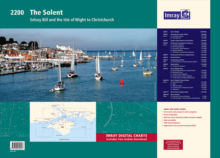
This 2021 edition includes the latest official UKHO data at time of publication, combined with additional information sourced from Imray`s network to make it ideal for small craft. The chart pack includes all the navigational charts and tidal data for passage, approach and mooring.Includes plans:2200.1 Isle of Wight1: 100 000 WGS 842200.2 Christchurch to the Solent1: 60 000 WGS 84Plans Lymington River, Christchurch2200.3 Eastern Approaches to the Solent1: 60 000 WGS 842200.4 Chichester & Langstone Harbours1: 35 000 WGS 84Plans Southsea Marina, Northney Marina, Emsworth Yacht Harbour, Sparkes Marina, Chichester and Birdham Marinas2200.5 Portsmouth Harbour & Approaches1: 22 500 WGS 842200.6 Central Solent1: 35 000 WGS 842200.7 Southampton Water1: 35 000 WGS 84Plans Continuation of Southampton Water2200.8 West Solent1: 35 000 WGS 84Plans Yarmouth Harbour2200.9 Isle of Wight PlansScale: various WGS 84Plans Bembridge Harbour & Approaches, Newtown River, Cowes & River Medina, Continuation of River Medina, Continuation of River Medina (2)2200.10 Isle of Wight & Solent PlansScale: various WGS 84Plans Wootton Creek, Ryde, Beaulieu River, Continuation of Beaulieu River, Keyhaven2200.11 River Itchen & Approaches1: 12 500 WGS 842200.12 River HambleScale: various WGS 84Plans Entrance to River Hamble, River Hamble – Continuation to Burlesdon

Related Products:
 2300 Dorset and Devon Coasts Chart Pack – 2019 edition
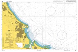
 Admiralty Chart SC5600_6 – Beaulieu River – Continuation of Beaulieu River – Isle of Wight, Newton River and Continuation
 C3 Isle of Wight
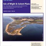 2200.9 Plans: Isle of Wight & Solent
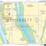
 Admiralty Chart SC5600_4 – Lymington River – Continuation of Lymington River – Isle of Wight Yarmouth Harbour, River Yar
 UK3 The Solent – 2019/20 Edition
 ADMIRALTY Leisure Folio SC5600 – the Solent & Approaches -19th edition
 2400 West Country Chart Pack – 2019 edition
 The Isle of Wight, Portsmouth and The Solent
 2000 Suffolk and Essex Chart Atlas – 2018 edition
 C15 The Solent
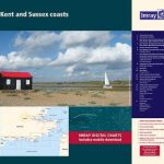 2100 Kent and Sussex Coasts Chart Atlas – 2021 edition
 2600 Bristol Channel Chart Atlas – 2016 edition
 C9 Beachy Head to the Isle of Wight
 The Solent, Isle of Wight, Southampton & Portsmouth OS Landranger Map 196 (paper)
 The Solent, Isle of Wight, Southampton & Portsmouth OS Landranger Active Map 196 (waterproof)
 UK4 Selsey Bill to London – 2019/20 Edition
 ADMIRALTY Leisure Folio SC 5613 – Irish Sea, Eastern Part including Isle of Man
 Stanford`s Chart of the Solent, Spithead and Southampton Water (1932) – A1 Wall Map, Canvas
Stanford`s Chart of the Solent, Spithead and Southampton Water (1932) – A2 Wall Map, Canvas
Stanford`s Chart of the Solent, Spithead and Southampton Water (1932) – Original Size Wall Map, Canvas
Stanford`s Chart of the Solent, Spithead and Southampton Water (1932) – A3 Wall Map, Paper – Print on Demand
Stanford`s Chart of the Solent, Spithead and Southampton Water (1932) – A2 Wall Map, Paper – Print on Demand
Stanford`s Chart of the Solent, Spithead and Southampton Water (1932) – A1 Wall Map, Paper – Print on Demand
Stanford`s Chart of the Solent, Spithead and Southampton Water (1932) – A3 Wall Map, Canvas – Print on Demand
Stanford`s Chart of the Solent, Spithead and Southampton Water (1932) – A1 Wall Map, Canvas
Stanford`s Chart of the Solent, Spithead and Southampton Water (1932) – A2 Wall Map, Canvas
Stanford`s Chart of the Solent, Spithead and Southampton Water (1932) – Original Size Wall Map, Canvas
Stanford`s Chart of the Solent, Spithead and Southampton Water (1932) – A3 Wall Map, Paper – Print on Demand
Stanford`s Chart of the Solent, Spithead and Southampton Water (1932) – A2 Wall Map, Paper – Print on Demand
Stanford`s Chart of the Solent, Spithead and Southampton Water (1932) – A1 Wall Map, Paper – Print on Demand
Stanford`s Chart of the Solent, Spithead and Southampton Water (1932) – A3 Wall Map, Canvas – Print on Demand
 Admiralty Chart SC5600_22 – River Medina – Continuation of River Medina – River Medina, Folly Point to Newport
Stanford`s Chart of the Solent, Spithead and Southampton Water (1932) – Original Size Wall Map, Paper – Print on Demand
Admiralty Chart SC5600_22 – River Medina – Continuation of River Medina – River Medina, Folly Point to Newport
Stanford`s Chart of the Solent, Spithead and Southampton Water (1932) – Original Size Wall Map, Paper – Print on Demand
 Y39 Poole Harbour – Laminated
 Walking on the Isle of Wight: 24 Coastal and Countryside Walks and the Isle of Wight Coastal Path
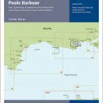
 Y39 Poole Harbour
 Isle of Wight A-Z Pocket Map
 Isle of Wight Street Atlas
 The Rough Guide to Dorset, Hampshire & the Isle of Wight (Travel Guide with Free eBook)
 Isle of Wight – Short Walks
 Isle of Wight A-Z Visitors` Wall Map
 Y30 Isle of Wight
 Isle of Wight OS Explorer OL29 ACTIVE
 Portrait of the Isle of Wight
 Isle of Wight From The Air
 Isle of Wight