Disclosure : This site contains affiliate links to products. We may receive a commission for purchases made through these links.
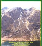
2000 Plus England: 254 Summits over 2000ft.

The 2000 Plus map of England showing summits over 2000ft (609.6m), together with markings for subsidiary tops and minor summits, combining them into 16 groups listed with full details and presented with mountain profiles.The main map at 1:250,000 shows the Pennines, with three insets at 1:350,000 covering the Peak District, Dartmoor and the Isle of Man. Altitude colouring provides an overall picture of the topography, and the ridges of the individual summit groups are annotated with main peaks, subsidiary tops, and minor summits ‘“ those over 2000ft but with insufficient reascent to merit classification as main or subsidiary. Each group is cross-referenced to the surrounding panels which provide for each one a list of all the peaks accompanied by mountain profile(s).The map also shows the road network and railway lines with stations, and indicates locations of YHA and independent hostels. Also marked are the sheet lines of the relevant Ordnance Survey 1:50,000 Landranger maps. The map cover includes useful notes and advice on the Mountain Rescue Service in England and Wales.


