Disclosure : This site contains affiliate links to products. We may receive a commission for purchases made through these links.
Categories
-
Best Sellers
-
Meadowfield 1897
Meadowfield in 1897 in a fascinating series of reproductions of old Ordnance Survey plans in the Alan Godfrey Editions, ideal for anyone interested in the history Read More » -

Aletschgebiet Swisstopo 2516
Map No. 2516, Aletschgebiet – STANDARD EDITION, in the topographic survey of Switzerland at 1:25,000 from Swisstopo, covering both sides of the Rhรดne Valley upstream from Read More » -

Samos Terrain Editions 331
Samos at 1:30,000 on a contoured, GPS compatible hiking map published by Terrain Cartography group together with Skai Maps, and printed on light, waterproof and tear-resistant Read More » -

Norway Flag – 1/2 yard – Printed
We are able to source a wide range of courtesy flags. Flags are available in many sizes and can be sewn or printed on 100% Ministry Read More » -

Shiphandling Logbook
This addition to the Nautical Institute’s suite of logbooks allows mariners to record and reflect on the shiphandling manoeuvres they carry out, either on board ship Read More » -

Inside The Peloton
Inside the Peloton, based on its author’s acclaimed diaries of life as a professional cyclist, is a fiercely honest account of the incredible sacrifices and effort Read More » -
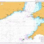
Admiralty Chart 1123 – Western Approaches to Saint George`s Channel
NEW EDITION OUT ON 27/02/2020Admiralty standard nautical charts comply with Safety of Life at Sea (SOLAS) regulations and are ideal for professional, commercial and recreational use. Read More » -

Admiralty Chart 836 – Mysingen to Jungfrufjarden
Admiralty standard nautical charts comply with Safety of Life at Sea (SOLAS) regulations and are ideal for professional, commercial and recreational use. Charts within the series Read More » -

The Ocean Book: How endangered are our seas?
Esther Gonstalla`s beautifully designed *The Ocean Book* is full of clear and informative diagrams and illustrations that pack a visual punch to shake us out of Read More » -
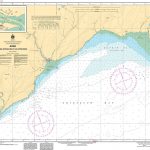
CHS Chart 4337 – Alma and Approaches
The official Canadian charts provide an excellent range of scales for the whole length of Canada`s coastline as well as the Grat Lakes and comply with Read More »
-


