Disclosure : This site contains affiliate links to products. We may receive a commission for purchases made through these links.
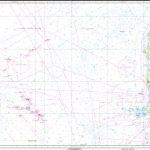
172 The Waters South of Funen (Fyn) – Rudkobing Lob
Official charts for the coast of Denmark produced by the Danish Hydrographic Office. The charts are ordered upon customer demand, therefore please contact us if you require the charts urgently.For any further information, you can contact maritime@stanfords.co.uk.

Related Products:
 171 The Waters South of Funen (Fyn) – Svendborg Sund
 152 Lillebaelt (Little Belt) – Southern Part and Waters South of Funen (Fyn)
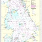
 114 Kattegat – The Waters North of Funen (Fyn)
 124 Kattegat – Waters South of Anholt
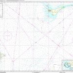
 80 The Waters around the Faroe Islands
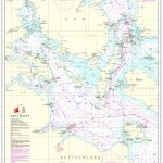
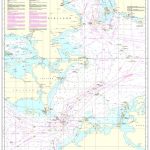
Chart C – Denmark with Surrounding Waters
80 The Waters around the Faroe Islands
Chart C – Denmark with Surrounding Waters
 Chart G – Greenland with Surrounding Waters
Official Charts of Greenland
Official Charts of Denmark
Chart G – Greenland with Surrounding Waters
Official Charts of Greenland
Official Charts of Denmark
 100 Kattegat
 103 Baelthavet
 Chart D – Maritime Boundaries of Denmark
Faroe Islands Official Charts
Chart D – Maritime Boundaries of Denmark
Faroe Islands Official Charts
 92 Skagerrak
188 Baltic Sea around Bornholm
92 Skagerrak
188 Baltic Sea around Bornholm
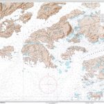
 81 Faroe Islands
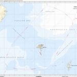 Chart F – Faroe Islands with Maritime Zones
 104 Baltic Sea – Femernbรฆlt to Sundet
 112 Kattegat – Arhus Bugt
 122 Kattegat – Alborg Bugt
 127 Kattegat – Arhus Havn
 128 Kattegat – Samso Baelt
129 Kattegat – Southeastern Part
128 Kattegat – Samso Baelt
129 Kattegat – Southeastern Part
 1000 Greenland Westcoast
 2000 Greenland Eastcoast
 189 Baltic Sea – Bornholmsgat
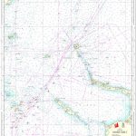
 60 Denmark, North Sea – Fano to Sylt
 116 Kattegat – Isefjord
 83 Faroe Islands, Southern Part
 1130 Greenland Westcoast – Frederiksdal
 1131 Greenland Westcoast – Nanortalik
 1132 Greenland Westcoast – Julianehab
1145 Greenland Westcoast – Kobberminebugt
1132 Greenland Westcoast – Julianehab
1145 Greenland Westcoast – Kobberminebugt
 1230 Greenland Westcoast – Frederikshab
 1530 Greenland Westcoast – Egedesminde
 61 Denmark, North Sea – Blavands Huk to Fano
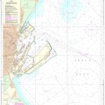
 95 Denmark, North Sea – Port of Esbjerg
 93 Denmark, North Sea – Esbjerg to Hanstholm
 196 Baltic Sea – Femern Baelt
157 Lillebaelt (Little Belt) – Vejle Fjord
196 Baltic Sea – Femern Baelt
157 Lillebaelt (Little Belt) – Vejle Fjord