Disclosure : This site contains affiliate links to products. We may receive a commission for purchases made through these links.
Thailand Handy Road Atlas
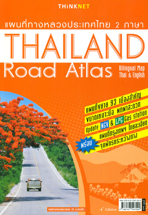
Road Atlas of Thailand from the Bangkok-based ThinkNet publishers, combining coverage of the country at 1:1,200,000, mapping of Bangkok and the surrounding region as 1:82,000, Bangkok itself at 1:2,000, plus over 100 street plans and or enlargements for other locations. All place names are in both Thai and Latin alphabets and where appropriate names of places of interest use English.The whole country is presented on 16 pages showing its road and rail networks at 1:1,200,000. The maps highlight numerous places of interest, show driving distances on main and secondary routes plus locations of border crossings, and very clearly indicate page numbers where enlargements and/or street plans can be found. Latitude and longitude are shown by margin ticks at 1ยบ intervals. The index is arranged by province (Changwat) and includes separate lists of tourist attractions, national parks, islands, temples, waterfalls, checkpoints, etc. Bangkok and the surrounding region are presented in greater detail on 30 pages at 1:82,000, with downtown Bangkok covered on 12 pages at 1:20,000. The index section for this part of the atlas lists roads and highways, plus various facilities including selected hotels, markets and department stores, stations, etc. Further street plans and enlargements at various scales also highlight various facilities and/or places of interest. Also provided is a comprehensive distance table, rail network diagram and an Expressway map of the Bangkok area. This 4th edition of the atlas published in 2013 comes with a CD for Windows XP, Vista, 7 and 8.PLEASE NOTE: place names on the maps, although clearly legible, are in smaller print size than usually found on maps and atlases.


