Disclosure : This site contains affiliate links to products. We may receive a commission for purchases made through these links.
Southeast Alaska and Inside Passage

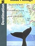
Alaska’s panhandle and the Canadian coastline southwards to Vancouver and onto Seattle on a map from Great Pacific Recreation and Travel Map with several street plans and exceptionally extensive lists of various facilities and places of interest.On one side is a map of the Alaska’s panhandle indicating cruise ship and ferry routes. Small islands, bays and inlets and other coastal features are named. On land colouring indicates national/state parks and other protected areas. Local roads are shown and symbols mark airports/airstrips and seaplane bases, trailheads, campsites and other places of interest. The map is accompanied by an extensive index listing physical features on land and sea; mountains, peaks, rivers, islands, inlets, peninsulas, bays, etc. Also provided is a separate list of towns indicating what facilities can be found there, plus a list of Alaska’s state and national parks, also indicating facilities. A separate panel extends coverage southwards along the Canadian coast to Vancouver and Seattle, with an index of towns and provincial parks. Another panel shows a street plan of Prince Rupert in Canada, with a list of various facilities and places of interest highlighted on the plan.On the reverse an enlargement presents the environs of Juneau is greater detail, with two separate panels providing street plans of the downtown and the airport areas. Further panels cover Wrangell, Ketchikan, Craig, Petersburg, Sitka, Skagway and Haines, with where appropriate enlargements for the downtown area. All the panels are accompanied by very extensive lists of numerous facilities and places of interest.


