Disclosure : This site contains affiliate links to products. We may receive a commission for purchases made through these links.
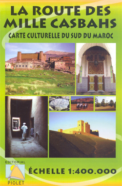
The Route of the Thousand Kasbahs FRENCH

Route of the Thousand Kasbahs across the southern side of the High Atlas Mountains shown at 1:400,000 on a map from Editorial Piolet with very clear presentation of the area’s topography, plus descriptions of sites on the reverse.Satellite imagery enhanced by bold relief shading very effectively presents the topography, with additional graphics for dunes, seasonal lakes and oasis, plus plenty of names geographical features. Road network include local tracks, indicating difficult routes. A range of symbols mark various places of interest, tourist accommodation including campsites, fossil collecting sites and rock paintings, sport and recreational facilities, etc. Settlements are annotated to show on which days of the week local markets are held. The map has a UTM grid and an index of cultural sites.On the reverse the region’s main sights are presented on colour photos, each with a brief description. Map legend and all the text are in French only.*The same map is also available with all the text and the map legend in Spanish.


