Disclosure : This site contains affiliate links to products. We may receive a commission for purchases made through these links.
Thuringian Forest – Rhon Cycling Map 17
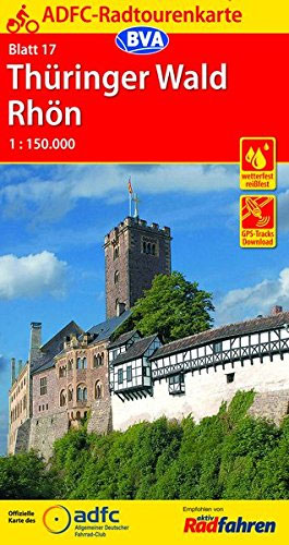
Thuringian Forest – Rhรถn: Wรผrzburg – Bamberg – Erfurt area of Germany in a series of waterproof and tear-resistant, GPS compatible cycling maps at 1:150,000 from the ADFC (Allgemeiner Deutscher Fahrrad-Club – the official German cycling federation), with extensive overprint for long-distance and local cycling routes. Maps in the ADFC series are contoured; the interval varies according to the type of the terrain. Steep sections are annotated with gradient markings. Colouring and/or graphics show various types of landscape: woods, vineyards, etc. An overprint highlights both the national long-distance cycling routes and the shorter local cycling trails, each clearly identified by a symbol and/or an abbreviation of its name. Sections with heavy traffic and/or poor road surface are clearly marked. Symbols indicate various facilities, such as railway stations with cycle hire, cycle repair shops, campsites, youth hostels, shelters, country restaurants/bars, sport and leisure facilities, etc. The maps have a 5-km UTM grid and each title covers an area of approx. 130 x 160km (81 x 100 miles). Map legend is in German only. Each title also provides details of online links for information about accommodation, GPS waypoints, route profiles, etc.To see all the titles in this series please click on the series link.


