Disclosure : This site contains affiliate links to products. We may receive a commission for purchases made through these links.
River Medway: the Upper Reaches – Rochester to Tonbridge
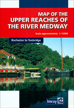
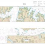
The Upper Reaches of the River Medway between Rochester and Tonbridge presented on a double-sided map from Imray, Laurie, Norie & Wilson, with lock enlargements, additional information and lists of useful organizations.The river is shown in three sections, annotated with depths (shallows at banks, depths in channel and drying depths), height clearance on bridges, overhead and underwater cables, slipways, hoists/cranes, moorings, visitors’ moorings and marinas. In the surrounding area the map shows the tow path, road and rail networks, public houses and tourist information points, etc. Locks or areas requiring more detail are presented enlarged on separate insets or profiles.The map included additional text with relevant information, plus contact details for various marinas, boatyards, clubs, and other organization.


