Disclosure : This site contains affiliate links to products. We may receive a commission for purchases made through these links.
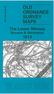
The Lower Mersey 1913 – 97
Related Products:
 Lower Clapton 1913 – 31.3
 Heaton Mersey 1907 – 10.14
 Ashton-on-Mersey 1927
 The Mersey Estuary: A Travel Guide
 Admiralty Chart 3478 – Manchester Ship Canal and Upper River Mersey
 Lower Wensleydale 1904-13 – 51
 Trekking Around Upper & Lower Mustang
 Lower Weardale & West Durham 1903 – 26
 Lower Rhine North Publicpress Cycling 166
 Lower Rhine – Kleve – Wesel 50K Kรผmmerly + Frey Map No. 61
 Unterengadin / Lower Engadine – Scuol – Samnaun K+F Hiking Map 24
 Bergisches Land – Ruhr – Lower Rhine Motorcycle Map
 Germany: Lower Saxony 50/40K Topographic Survey Leisure Maps
 Heanor 1913 – 45.04
 Uxbridge 1913 – 14.03b
 Methil 1913 – 28.08a
 Longbenton 1913 – 31
 Old Thornaby 1913 – 56.04
 Morriston 1913 – 15.09
 Willenhall SW 1913 – 62.12b
 Walsall (SW) 1913 – 63.10b
 Walsall (SE) 1913 – 63.11b
 Walsall (NW) 1913 – 63.06b
 Bilston 1913 – 62.16c
 Smethwick 1913 – 72.03b
 Lower Rhine – Krefeld – Moers – Straelen Publicpress Cycling and Hiking 675
 Cowdenbeath (West) 1913 – 34.11
 South Ealing 1913 – 70.3
 Darley Abbey 1913 – 50.05
 Forest Hall 1913 – 32
 Sunderland (Fulwell) 1913 – 8.06
 Darlington (South) 1913 – 55.10b
 Yarm & Egglescliffe 1913 – 56.11
 Birmingham (East) 1913 – 14.06b
 Wakefield (North) 1913 – 248.03b
 Wakefield (South) 1913 – 248.07b
 Middleton St George 1913 – 55.12
 Lofthousegate & Outwood 1913 – 233.11
 Battersea & Fulham 1913 – 100.3
 Willenhall (NW) & Wednesfield 1913 – 62.08b


